Waterfalls Await on Mt. Tamalpais' Cataract Trail
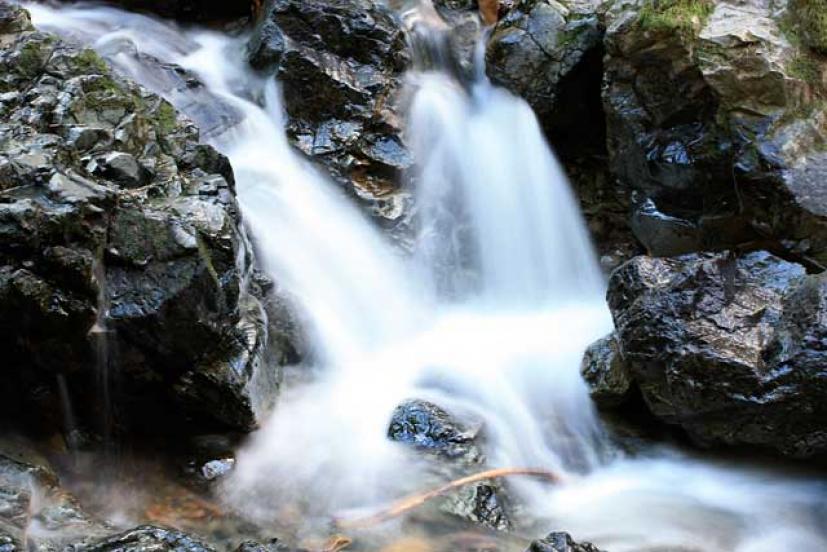
 During winter and early spring, and especially after a rainstorm, a family hike along on Mount Tamalpais's cataract trail will reward you with stunning scenery and a series of spectacular waterfalls. This out-and-back hike is about 2.6 miles round trip, and should be manageable by most kids—we saw plenty of families on the trail during out last trek.
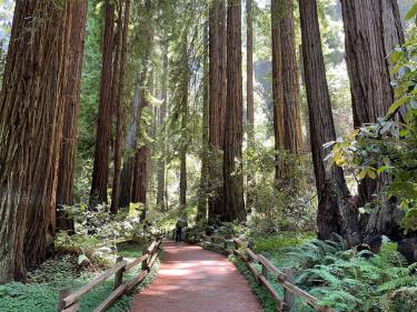
The trail is on the Mt. Tam lands administered by the Marin Municipal Water District, and follows Cataract Creek as it flows gently downhill. You'll pass through a magical forest of Douglas firs, oaks, ferns, and moss-covered rocks on the way to Laurel Dell picnic area. Pass through Laurel Dell and the trail heads downhill to the first in a series of waterfalls.
The easiest approach to the Cataract Trail for families is from the Rock Spring trailhead, which is at the junction of East and West Ridgecrest Boulevards. Park here and head out onto the Cataract Trail, the beginning of which you'll find off the center of the parking area. There is an alternate approach from Bolinas–Fairfax Road, near Alpine Dam, but the trail here is largely uphill, and parking along the road can be difficult.


The hike is approximately one mile to Laurel Dell, and about a quarter mile after that to the first falls. While sections of the trail are flat, there are several technical parts that involve climbing over rocks and tree rooks or negotiating short but steep sections. The kids thought the forest, with its twisted trees and bright green moss and foliage, was amazing, like something out of The Lord of the Rings or Harry Potter.
Numerous little wooden bridges cross the creek, and areas of the trail are stair-stepped for easier climbing, but there's nothing here that's really too steep. When you get to Laurel Dell, cross through the picnic area and pick up the Cataract Trail on the other side. The trail will start to head downhill, and you'll see the first of several waterfalls to your left. As you hike downhill the falls get larger and more magnificent, but do keep in mind that you have to hike back up the trail to get back to Rock Spring!
If you're up for it, it's a worthwhile family winter hike and an experience you and your kids won't soon forget. Expect the hike to take about two hours or so total.


If You Go
To get there, take Highway 101 to the Highway 1/Stinson Beach exit in Mill Valley. Take Highway 1 west, then bear right onto Panoramic Highway (follow the signs to Muir Woods and Mt. Tamalpais). Follow Panoramic Highway north onto Mt. Tam. Turn right onto Pan Toll Road and then right on East Ridgecrest Boulevard at the Rock Spring parking area. Parking is free here.
It’s best to have either a backpack carrier or kids who can hike themselves here. Strollers won't be able to handle the often rocky terrain. During the winter and spring months, Mt. Tam can be cold, so wear layered clothing and bring rain gear, just in case. The trail can be muddy in spots, so wear appropriate footwear that you don't mind getting dirty.


Restrooms are available at Rock Spring trailhead and Laurel Dell picnic area. Make sure you bring plenty of drinking water and snacks.
An alternate approach is to go with another group and use two cars. Drop one car off in a roadside spot down on Fairfax-Bolinas Road and then drive everyone on to Rock Spring, where a one-way hike ends up on Fairfax-Bolinas Road again.